ITCZ Breakdown
The Intertropical Convergence Zone is an important feature of the tropical atmosphere. When averaged over longitude and months or years of time, a clear band of upward-moving air, part of the broader atmospheric circulation, becomes apparent. However, when looking over shorter timescales, the ITCZ signal becomes more complex. Often, the ITCZ can be picked out as a belt of deep convection on satellite imagery. However, the latitudinal position and zonal structure of this belt can vary on both day-to-day and seasonal scales.
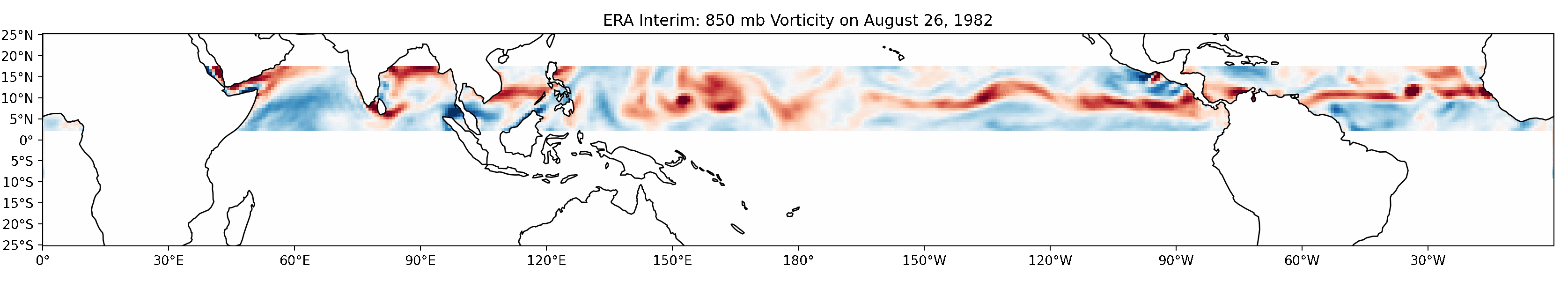
An important part of this day-to-day variation is the process of “ITCZ Breakdown.” Breakdown occurs when a region of the belt of storms undulates, then breaks into individual storm clusters (which can sometimes go on to form tropical cyclones). Plenty of studies have tried modeling breakdown phenomenon, but little has been done to identify and characterize real-world occurrances of these breakdown events. Do observations of ITCZ breakdown match what models show, and what theory predicts? And if not, why not?
About this Project
I’ve conducted this project as undergraduate research under Anantha Aiyyer. Dr. Aiyyer has been incredibly helpful to me even before I graduated high school, and I’m thankful for his continued support and guidance on this project (and more).